Wikipedia says: Greenleaf’s Point is an urbanized area located on the peninsula formed by the confluence of the Potomac and Anacostia Rivers in the southwest quadrant of Washington, D.C., United States.
The earliest documented name for the tip of the peninsula that now constitutes the area known as Buzzard Point was Turkey Buzzard Point, in use by 1673 when it appeared on a map published by Augustine Herman, a Bohemian explorer and one of the early European settlers of the Eastern Shore of Maryland. This name — often shortened to Buzzard Point — remained in use until the federal capital was planned during the 1790s, at which time it became Young’s Point, from one Notley Young, the then owner of the land. Very soon after that, it was renamed Greenleaf’s Point — or Greenleaf Point — after James Greenleaf, a land speculator and purchaser of numerous lots in the new city, many of which were located in the vicinity of the Point.
Military history
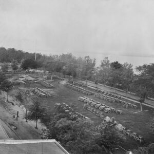
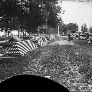
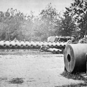
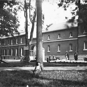
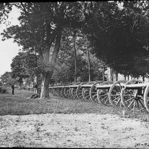
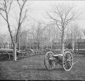
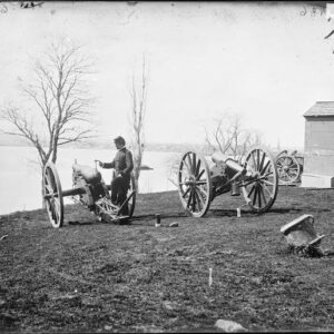
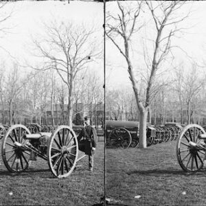
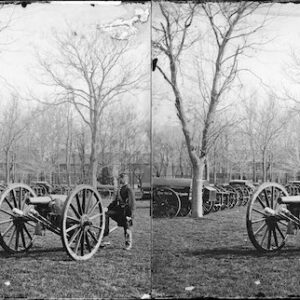
George Washington had intended the military to use some of Greenleaf’s lots at the Point, including for defensive works. In 1791, he and Pierre (Peter) Charles L’Enfant chose the site for the emplacement of a redoubt of some sort. They acquired approximately 28 acres (110,000 m2) by a deed of trust during that year and confirmed it in a July 25, 1798, executive order. L’Enfant intended for a fortification to be placed there, according to his city plan, setting it aside as “Military District No. 5”, because, as one author wrote, the “peninsula where the Potomac and Anacostia Rivers met was an obvious, natural military site.” This site, sported a “one-gun battery mounted behind earth breastworks,” possibly as early as 1791 but, at any rate, definitely by 1794. Within a few years, “The U.S. Arsenal at Greenleaf Point” grew from 28 to more than 89 acres (360,000 m2). By 1803, the “Fort” was first referred to as an “Arsenal”, and Congress provided money to construct additional buildings.
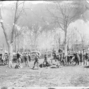
During the American Civil War, experiments on new weaponry were performed both at the nearby Washington Navy Yard and the Washington Arsenal as the Army installation had come to be named. Breechloaders, the Spencer carbine, and the Gatling gun were among the weapons tested on the peninsula.
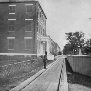
From its earliest times, the Point was primarily ignored by the larger population of the District, much as in a larger sense all of Southwest Washington (referred to as “The Island” for its isolation) remained somewhat distinct. L’Enfant’s and Washington’s hopes for bustling river traffic at Buzzard Point wharves never came to be; instead, the area south of Q Street SW and between South Capitol and the Fort retained a predominantly rural aspect. Wrote an early resident of this period: “From the Navy Yard westward along the Eastern Branch [the Anacostia] to Greenleaf’s Point was a wild stretch of land with here and there a hovel or a house, and a stouring of brick kilns.” The marshy James Creek, flowing alongside the Arsenal (canalized in 1866 as the James Creek Canal but never connected to the existing Washington Canal), served only as a source of disease, often used for trash dumping.