Tag: Dutch Gap VA
Wikipedia says: The Dutch Gap Canal was named for its location at Dutch Gap, which was formerly a neck of land that joined Farrar’s Island to the mainland. The James River around Farrar’s Island, from Drewry’s Bluff to the confluence of the Appomattox River below Bermuda Hundred, originally had a number of meandering loops. The Dutch Gap was the isthmus between the narrowest of these loops. Here, the James River on the west bank of the isthmus created what was called the “Seven Mile Loop” that formed Farrar’s Island before returning to the east bank. However, the distance between the east and west banks at this point was less than 200 yards wide. and the elevation ranged from 3 feet to 39 feet above the level of the river.
The name “Dutch Gap” has been historically associated with the founding of Henricus by the Virginia Company of London in 1611 by Sir Thomas Dale, and it was also known as “Dale’s Dutch Gap”. The name is attributed to a palisaded fosse that Dale is thought to have built across the neck to protect the town from attack on the north side of the river. It is claimed to have been named the “Dutch Gap” because Dale is thought to have learned the fortification technique when he served as a mercenary for the Dutch Republic prior to his employment with the Virginia Company. Between 1619 and 1624, Dutch Gap was part of the City of Henrico. In 1637, it became part of a patent claimed as an inheritance by the son of councillor and commissioner, William Farrar. As a result of this patent, the land enclosed by the loop of the James just below Dutch Gap eventually got its name, Farrar’s Island.
Civil War History
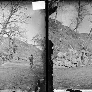
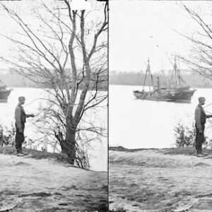
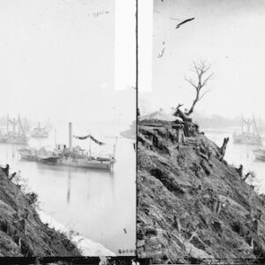
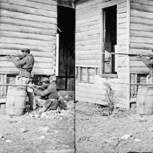
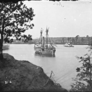
During the American Civil War in late August, 1864, General Benjamin Butler, commander of the Union Army of the James, ordered the construction of a canal at Dutch Gap. One purpose of the canal was to allow ships to bypass the loop of the James river around Farrar’s Island, which was controlled by Confederate batteries. Of particular threat was Battery Dantzler at the northern end of the Howlett Line where Confederate forces had installed two seven-inch Brooke rifles, two ten-inch Columbiad guns, and two siege mortars that had a half mile field of fire on the James River that lay on the east side of Farrar’s Island. Another purpose was to continue military activity as part of the larger Petersburg Campaign to ensure that Confederate manpower resources remained strained in Eastern Virginia and unable to redeploy to other sectors.
Due to the geography of the area, the canal was dug just south of the narrowest point of Dutch Gap, and was about 175 yards long when completed. The construction was often performed under fire, as batteries from both sides engaged in daily duels. At times, the Confederate artillery was effective in slowing down the rate of construction with indirect fire, as when it sank the Union dredge being used to deepen the canal. In January 1865, the cut across the isthmus was complete, but the explosion used to remove the bulkhead to open the canal threw much of the bulkhead’s earth back into the canal. Dredging had to continue to the end of the war and the canal remained unusable for armed ships.
Showing all 10 results