| Credit: | by OSullivan (Timothy H.) |
|---|---|
| Date: | 1865.04 |
| Negative Size: | 8 in. x 10 in. |
| Locations & Lines: | Appomattox River; Farmville VA; Southside Railroad (SS); Virginia |
| Military Units: | US Military Railroads (USMRR); US Army |
| Structures & Establishments: | SS High Bridge (Appomattox River) |
| Sources: | Library of Congress |
$6.99
File Details: AJBYm, 800 DPI, TIFF, Original Photograph, 39.7 Mb
Image ID: AJBY
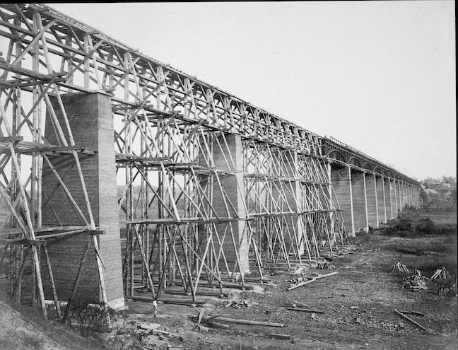
Gardners Photographic Sketch Book Of The War. Vol. 2, No. 98. High Bridge crossing the Appomattox, near Farmville, on South Side Railroad, Va. 1865. The South Side Railway, between Petersburg and Lynchburg, crosses the Appomattox river and its broad valley, by what is now well known as High Bridge. With one exception, it is the highest structure of the kind on this continent, being one hundred and twenty-eight feet above the level of the river, and two thousand four hundred feet in length.
On the morning of the 7th of the April, 1865, the Second Corps of the Army of the Potomac, in pursuit of the enemy, came up with them at this point. The Confederate endeavored not only to burn the railroad bridge, but also the common road bridge, which crosses the river a short distance below. The latter was fortunately saved, and but three spans of the former burned. The picture shows that this damage has since been repaired by substitution of a trestle bridge along the sections destroyed. Owing to the great height of the piers, and the haste with which the bridge was repaired, it is now rather insecure, rendering it necessary for the trains to pass over at a very slow rate of speed. At high water the river covered the whole of the flats, and extended above the stove base of the piers.
Miller, Photographic History of the Civil War, Vol. 3, p311.
